Geolocate

Swan River topographic map

Click on the map to display elevation.

About this map

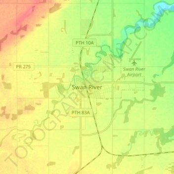
Name: Swan River topographic map, elevation, terrain.

Location: Swan River, Manitoba, R0I 1Z0, Canada (52.06506 -101.31054 52.14506 -101.23054)

Average elevation: 341 m

Minimum elevation: 312 m

Maximum elevation: 368 m

Manitoba trails, hiking, mountain biking, running and outdoor activities

Gear up for your next adventure:

🚲Bike Repair Kit - Essential tools for on-trail mechanical issues
🧢Outdoor Visor - Breathable visor for sunny hikes
🚑Survival Whistle - Signal for help across long distances in mountains
🔦UV Flashlight - Detect minerals or specific insects in the dark
🛶Kayak Dry Bag - Waterproof storage for kayaking adventures

As an Amazon Associate, this site earns from qualifying purchases at no extra cost to you.