Geolocate

Yaca topographic map

Click on the map to display elevation.

About this map

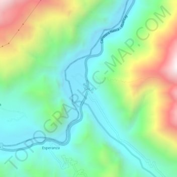
Name: Yaca topographic map, elevation, terrain.

Location: Yaca, Circa, Provincia de Abancay, Apurímac, Perú (-13.86986 -72.99811 -13.82986 -72.95811)

Average elevation: 2,365 m

Minimum elevation: 1,969 m

Maximum elevation: 3,253 m

Gear up for your next adventure:

🧥Waterproof Pants - Keep dry during rainy hiking conditions
🦶Anti-Blister Balm - Prevents friction and hotspots during long ascents
🧴Insect Repellent - Protect yourself from bugs during outdoor adventures
🚲Heavy Duty Bike Lock - Secure your bike at the trailhead or during stops
🧰Survival Kit - Essential gear for emergencies in the wilderness

As an Amazon Associate, this site earns from qualifying purchases at no extra cost to you.