Geolocate

Burghfield topographic map

Click on the map to display elevation.

About this map

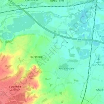
Name: Burghfield topographic map, elevation, terrain.

Location: Burghfield, West Berkshire, England, United Kingdom (51.39262 -1.07834 51.43670 -0.99790)

Average elevation: 53 m

Minimum elevation: 33 m

Maximum elevation: 101 m

Gear up for your next adventure:

🪑Insulated Seat Pad - Protect your seat from cold rocks and wet logs
🔭Outdoor Binoculars - Lightweight binoculars for birdwatching and hiking
💧Reusable Water Bottle - Durable water bottles for hydration on trails
🔥Camping Stove - Portable stoves to cook outdoors with ease
Camping Essentials - All-in-one gear for a comfortable camping trip

As an Amazon Associate, this site earns from qualifying purchases at no extra cost to you.