Geolocate

Edgewood topographic map

Click on the map to display elevation.

About this map
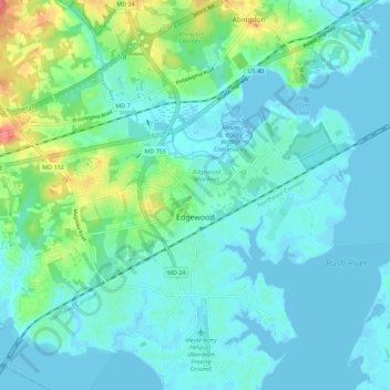
Name: Edgewood topographic map, elevation, terrain.

Location: Edgewood, Harford County, Maryland, United States (39.38041 -76.34871 39.46149 -76.24735)

Average elevation: 12 m

Minimum elevation: -4 m

Maximum elevation: 58 m

Other topographic maps

Click on a map to view its topography, its elevation and its terrain.

Ashby Place

United States > Maryland > Harford County > Edgewood

Average elevation: 22 m

Gear up for your next adventure:

🧦Hiking Liner Socks - Thin base layer to prevent friction and blisters
🏃Hydration Running Vest - Carry water and maps close to your body for speed
🛏️Sleeping Bag - Warm and compact sleeping bags for outdoor camping
🥘Camping Cookware Set - Compact nesting pots and pans for trail cooking
🧴Outdoor Sunscreen - High SPF protection for high-altitude UV exposure

As an Amazon Associate, this site earns from qualifying purchases at no extra cost to you.