Geolocate

Neudoerfel topographic map

Click on the map to display elevation.

About this map
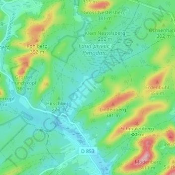
Name: Neudoerfel topographic map, elevation, terrain.

Location: Neudoerfel, Dambach, Haguenau-Wissembourg, Bas-Rhin, Collectivité européenne d'Alsace, Grand Est, France métropolitaine, 67110, France (49.01010 7.60078 49.05010 7.64078)

Average elevation: 271 m

Minimum elevation: 223 m

Maximum elevation: 398 m

Other topographic maps

Click on a map to view its topography, its elevation and its terrain.

Château de Schoeneck

France > Grand Est > Bas-Rhin > Dambach > Kehlenhof

Le château est construit sur une barre rocheuse à 380 m d'altitude et à 2,6 km au nord-est de Dambach, dans le département français du Bas-Rhin.

Average elevation: 312 m

Gear up for your next adventure:

🏕️Camping Hammock - Integrated protection for sleeping between trees
🦶Hiking Shoe Insoles - Added support for high arches and long days on feet
🧤Insulated Winter Gloves - Heavy-duty protection for sub-zero Canadian adventures
🧢Sun Hat - Wide-brim hat for sun protection
🩹Compact First Aid Kit - Pre-packed essentials for common trail injuries

As an Amazon Associate, this site earns from qualifying purchases at no extra cost to you.