Geolocate

Omaopio topographic map

Click on the map to display elevation.

About this map

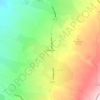
Name: Omaopio topographic map, elevation, terrain.

Location: Omaopio, Kula, Maui County, Hawaii, 96768, United States (20.78000 -156.34806 20.82000 -156.30806)

Average elevation: 666 m

Minimum elevation: 400 m

Maximum elevation: 994 m

Gear up for your next adventure:

💡Compact LED Flashlight - Powerful and portable flashlight for outdoor use
🥾All-Terrain Hiking Boots - Versatile boots for varied hiking conditions
🧦Hiking Liner Socks - Thin base layer to prevent friction and blisters
🚲Bike Repair Kit - Essential tools for on-trail mechanical issues
👟Trail Running Shoes - Agile footwear for fast-paced topographic exploration

As an Amazon Associate, this site earns from qualifying purchases at no extra cost to you.