
Thank you for supporting this site ❤️
Make a donation
Make a donation
Gear up for your next adventure:
As an Amazon Associate, this site earns from qualifying purchases at no extra cost to you.
Anta topographic map
Click on the map to display elevation.
Thank you for supporting this site ❤️
Make a donation
Make a donation
Gear up for your next adventure:
As an Amazon Associate, this site earns from qualifying purchases at no extra cost to you.
About this map
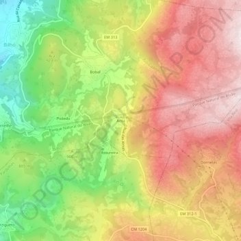
Name: Anta topographic map, elevation, terrain.
Location: Anta, Bilhó, Mondim de Basto, Vila Real, 4880-071, Portugal (41.37371 -7.84780 41.41371 -7.80780)
Average elevation: 934 m
Minimum elevation: 580 m
Maximum elevation: 1,237 m
Thank you for supporting this site ❤️
Make a donation
Make a donation
Gear up for your next adventure:
As an Amazon Associate, this site earns from qualifying purchases at no extra cost to you.