Geolocate

Chengue topographic map

Click on the map to display elevation.

About this map

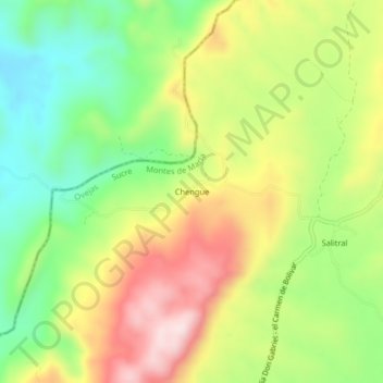
Name: Chengue topographic map, elevation, terrain.

Location: Chengue, Ovejas, Montes de María, Sucre, RAP Caribe, Colombia (9.63207 -75.32012 9.67207 -75.28012)

Average elevation: 343 m

Minimum elevation: 163 m

Maximum elevation: 562 m

Gear up for your next adventure:

🚑Survival Whistle - Signal for help across long distances in mountains
🧦Merino Wool Socks - Moisture-wicking comfort for long-distance hiking
🥾Trail Hiking Boots - Supportive boots for rough trails
🥾Light Hiking Boots - Lightweight and comfortable boots for day hikes
🧥Insulated Jacket - Keep warm in cold outdoor conditions

As an Amazon Associate, this site earns from qualifying purchases at no extra cost to you.