Geolocate

Al Hili topographic map

Click on the map to display elevation.

About this map
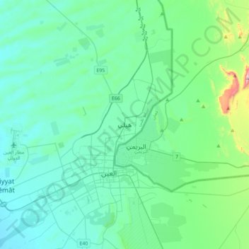
Name: Al Hili topographic map, elevation, terrain.

Location: Al Hili, Al Ain, Abu Dhabi Emirate, United Arab Emirates (24.24712 55.72753 24.32712 55.80753)

Average elevation: 290 m

Minimum elevation: 270 m

Maximum elevation: 353 m

Gear up for your next adventure:

🥾All-Terrain Hiking Boots - Versatile boots for varied hiking conditions
🧰Multitool Knife - Compact and versatile tool for outdoor use
☕Camping Coffee Maker - Brew fresh coffee anywhere on the topographic map
🔥Emergency Fire Starter - Reliable ignition source for all weather conditions
🦌Outdoor Trail Camera - Monitor wildlife activity near your favorite spots

As an Amazon Associate, this site earns from qualifying purchases at no extra cost to you.