
Wald-Wild-Schongebiet topographic map
Interactive map
Click on the map to display elevation.
About this map
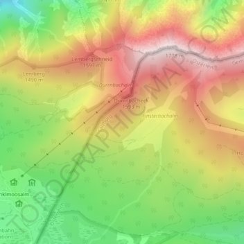
Name: Wald-Wild-Schongebiet topographic map, elevation, terrain.
Average elevation: 1,336 m
Minimum elevation: 926 m
Maximum elevation: 1,739 m
Other topographic maps
Click on a map to view its topography, its elevation and its terrain.
Sonntagshorn
Autriche > Salzbourg > Gemeinde Unken
Sonntagshorn, Gemeinde Unken, Zell am See, Salzbourg, 5091, Autriche
Average elevation: 1,476 m