Geolocate

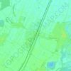
67150 topographic map

Click on the map to display elevation.

About this map

Name: 67150 topographic map, elevation, terrain.

Location: 67150, Erstein, Sélestat-Erstein, Bas-Rhin, Grand Est, France métropolitaine, France (48.33963 7.57217 48.48556 7.75332)

Average elevation: 152 m

Minimum elevation: 140 m

Maximum elevation: 164 m

Other topographic maps

Click on a map to view its topography, its elevation and its terrain.

Krafft

France > Grand Est > Bas-Rhin > Erstein

Average elevation: 150 m

Erstein-Gare

France > Grand Est > Bas-Rhin > Erstein

Average elevation: 154 m

Erstein-Gare

France > Grand Est > Bas-Rhin > Erstein

Average elevation: 154 m

Erstein-Gare

France > Grand Est > Bas-Rhin > Erstein

Average elevation: 154 m

Gear up for your next adventure:

🥾Trekking Poles - Adjustable trekking poles to reduce knee stress and improve stability
🪑Ultralight Camping Stool - Compact seating for rest stops during long hikes
👟Trail Running Shoes - Agile footwear for fast-paced topographic exploration
⛺Camping Tent - Weather-resistant tents suitable for 2 to 6 people
🧢Sun Hat - Wide-brim hat for sun protection

As an Amazon Associate, this site earns from qualifying purchases at no extra cost to you.