
Czar topographic map
Interactive map
Click on the map to display elevation.
About this map
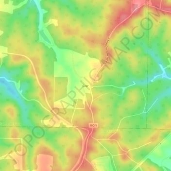
Name: Czar topographic map, elevation, terrain.
Location: Czar, Crawford County, Missouri, 65566, United States (37.73310 -91.13847 37.77310 -91.09847)
Average elevation: 350 m
Minimum elevation: 296 m
Maximum elevation: 400 m