Geolocate

Alfalfar topographic map

Click on the map to display elevation.

About this map

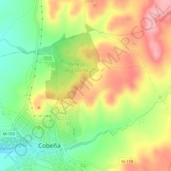
Name: Alfalfar topographic map, elevation, terrain.

Location: Alfalfar, Cobeña, Comunidad de Madrid, 28863, España (40.56701 -3.50728 40.58701 -3.48728)

Average elevation: 715 m

Minimum elevation: 653 m

Maximum elevation: 776 m

Gear up for your next adventure:

🔋Emergency Crank Radio - Weather alerts and power without needing batteries
🧼Travel Hand Sanitizer - Keep hands clean when water is scarce
👖Convertible Hiking Pants - Zip-off legs to adapt to changing weather conditions
🧤Thermal Hiking Gloves - Grip-enhanced gloves for cold-weather altitude trekking
💧Filtered Water Bottle - Safe drinking water on the go

As an Amazon Associate, this site earns from qualifying purchases at no extra cost to you.