Geolocate

Nullarbor topographic map

Click on the map to display elevation.

About this map

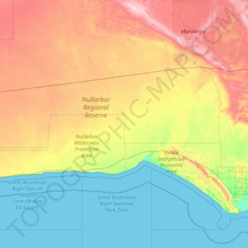
Name: Nullarbor topographic map, elevation, terrain.

Location: Nullarbor, Pastoral Unincorporated Area, South Australia, 5690, Australia (-31.68766 129.00192 -30.45702 132.10477)

Average elevation: 88 m

Minimum elevation: 0 m

Maximum elevation: 324 m

Other topographic maps

Click on a map to view its topography, its elevation and its terrain.

Gear up for your next adventure:

🧴Sunscreen SPF - Broad-spectrum sunscreen for outdoor activities
🦶Anti-Blister Balm - Prevents friction and hotspots during long ascents
🧭GPS Tracker - Track your location in remote areas safely
🛰️Satellite Messenger - Emergency communication for areas with no cell service
🧦Hiking Socks - Moisture-wicking and comfortable socks for long hikes

As an Amazon Associate, this site earns from qualifying purchases at no extra cost to you.