
Thank you for supporting this site ❤️
Make a donation
Make a donation
Gear up for your next adventure:
As an Amazon Associate, this site earns from qualifying purchases at no extra cost to you.
Jashuda topographic map
Click on the map to display elevation.
Thank you for supporting this site ❤️
Make a donation
Make a donation
Gear up for your next adventure:
As an Amazon Associate, this site earns from qualifying purchases at no extra cost to you.
About this map
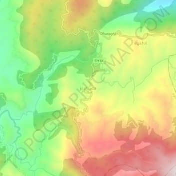
Name: Jashuda topographic map, elevation, terrain.
Location: Jashuda, Pati, Champawat, Uttarakhand, 262528, India (29.34783 79.94399 29.38783 79.98399)
Average elevation: 1,715 m
Minimum elevation: 1,405 m
Maximum elevation: 2,056 m
Thank you for supporting this site ❤️
Make a donation
Make a donation
Gear up for your next adventure:
As an Amazon Associate, this site earns from qualifying purchases at no extra cost to you.