
Al Jazirah topographic map
Interactive map
Click on the map to display elevation.
About this map
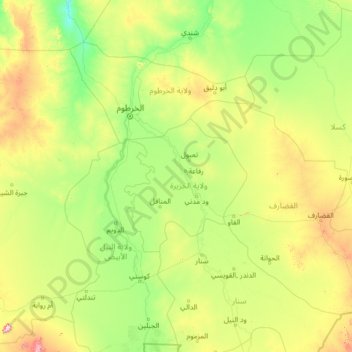
Name: Al Jazirah topographic map, elevation, terrain.
Location: Al Jazirah, Soudan (12.10715 30.66236 17.22715 35.78236)
Average elevation: 449 m
Minimum elevation: 314 m
Maximum elevation: 1,353 m
Other topographic maps
Click on a map to view its topography, its elevation and its terrain.