Geolocate

Carlow topographic map

Click on the map to display elevation.

About this map

Name: Carlow topographic map, elevation, terrain.

Location: Carlow, County Carlow, Leinster, Ireland (52.81763 -6.95779 52.85115 -6.87725)

Average elevation: 57 m

Minimum elevation: 41 m

Maximum elevation: 92 m

Other topographic maps

Click on a map to view its topography, its elevation and its terrain.
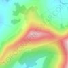
Greenoge

Ireland > County Carlow

Average elevation: 272 m

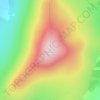
Slievebawn

Ireland > County Carlow

Average elevation: 315 m

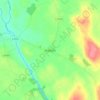
Tinryland

Ireland > County Carlow

Average elevation: 72 m

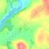
Ardattin

Ireland > County Carlow

Average elevation: 83 m

Blackstairs Mountain

Ireland > County Carlow

Average elevation: 429 m

Borris

Ireland > County Carlow

Average elevation: 60 m

Coolnamara Cross Roads

Ireland > County Carlow

Average elevation: 65 m

Borris

Ireland > County Carlow

Average elevation: 60 m

Borris

Ireland > County Carlow

Average elevation: 60 m

Gear up for your next adventure:

🕶️Polarized Sunglasses - Protect your eyes with durable polarized lenses
⛺Camping Groundsheet - Protect your tent from moisture and dirt
🥾Trekking Poles - Adjustable trekking poles to reduce knee stress and improve stability
🧶550 Survival Paracord - Versatile utility cord for emergency repairs and rigging
🧣Evaporative Cooling Towel - Beat the heat during intense summer climbs

As an Amazon Associate, this site earns from qualifying purchases at no extra cost to you.