
Thank you for supporting this site ❤️
Make a donation
Make a donation
Gear up for your next adventure:
As an Amazon Associate, this site earns from qualifying purchases at no extra cost to you.
Adrasan topographic map
Click on the map to display elevation.
Thank you for supporting this site ❤️
Make a donation
Make a donation
Gear up for your next adventure:
As an Amazon Associate, this site earns from qualifying purchases at no extra cost to you.
About this map
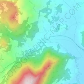
Name: Adrasan topographic map, elevation, terrain.
Location: Adrasan, Kumluca, Antalya, Mediterranean Region, 07370, Turkey (36.31033 30.41251 36.35033 30.45251)
Average elevation: 223 m
Minimum elevation: 2 m
Maximum elevation: 832 m
Thank you for supporting this site ❤️
Make a donation
Make a donation
Gear up for your next adventure:
As an Amazon Associate, this site earns from qualifying purchases at no extra cost to you.