
Lake Havasu City topographic map
Interactive map
Click on the map to display elevation.
About this map
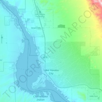
Name: Lake Havasu City topographic map, elevation, terrain.
Location: Lake Havasu City, Mohave County, Arizona, United States (34.43029 -114.37581 34.58960 -114.24202)
Average elevation: 279 m
Minimum elevation: 135 m
Maximum elevation: 1,256 m
Other topographic maps
Click on a map to view its topography, its elevation and its terrain.
Kingman
United States > Arizona > Mohave County
Kingman, Mohave County, Arizona, United States
Average elevation: 1,131 m
Centennial Park
United States > Arizona > Mohave County
Centennial Park, Mohave County, Arizona, 86021, United States
Average elevation: 1,504 m
Topock
United States > Arizona > Mohave County > Topock
Topock, Mohave County, Arizona, United States
Average elevation: 180 m
Bullhead City
United States > Arizona > Mohave County > Bullhead City
Bullhead City, Mohave County, Arizona, 89029, United States
Average elevation: 571 m