
Thank you for supporting this site ❤️
Make a donation
Make a donation
Gear up for your next adventure:
As an Amazon Associate, this site earns from qualifying purchases at no extra cost to you.
Lingmethang topographic map
Click on the map to display elevation.
Thank you for supporting this site ❤️
Make a donation
Make a donation
Gear up for your next adventure:
As an Amazon Associate, this site earns from qualifying purchases at no extra cost to you.
About this map
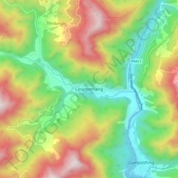
Name: Lingmethang topographic map, elevation, terrain.
Location: Lingmethang, Thridangbi, Saling Gewog, Mongar District, Bhutan (27.22098 91.13137 27.30098 91.21137)
Average elevation: 1,113 m
Minimum elevation: 507 m
Maximum elevation: 1,993 m
Thank you for supporting this site ❤️
Make a donation
Make a donation
Gear up for your next adventure:
As an Amazon Associate, this site earns from qualifying purchases at no extra cost to you.