Geolocate

Houston topographic map

Click on the map to display elevation.

About this map

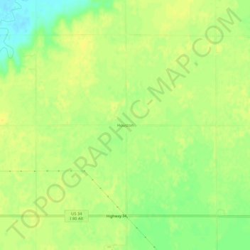
Name: Houston topographic map, elevation, terrain.

Location: Houston, York County, Nebraska, United States (40.89585 -97.56005 40.93585 -97.52005)

Average elevation: 500 m

Minimum elevation: 486 m

Maximum elevation: 507 m

Gear up for your next adventure:

💧Hydration Bladder - Hands-free hydration solution for long treks
🧥Packable Rain Jacket - Breathable waterproof layer for unpredictable weather
🧢Hiking Sun Hat - Wide-brimmed protection for exposed mountain ridges
🥾Trail Hiking Shoes - Durable shoes designed for rugged trails
🍽️Titanium Camping Spork - Ultralight and indestructible eating utensil

As an Amazon Associate, this site earns from qualifying purchases at no extra cost to you.