Geolocate

Rodt topographic map

Click on the map to display elevation.

About this map

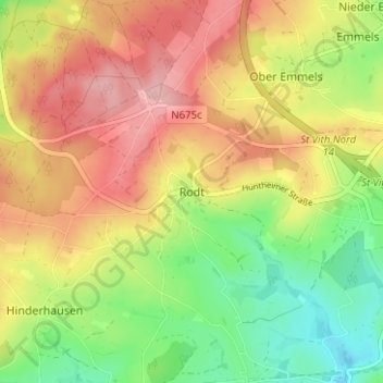
Name: Rodt topographic map, elevation, terrain.

Location: Rodt, Saint Vith, Verviers, Liège, Wallonia, 4780, Belgium (50.26707 6.05061 50.30707 6.09061)

Average elevation: 516 m

Minimum elevation: 447 m

Maximum elevation: 583 m

Other topographic maps

Click on a map to view its topography, its elevation and its terrain.

Crombach

Belgium > Liège > Verviers > Saint Vith

Average elevation: 500 m

4780

Belgium > Liège > Verviers > Saint Vith > Emmels

Average elevation: 502 m

Gear up for your next adventure:

🦶Hiking Shoe Insoles - Added support for high arches and long days on feet
🥾Mountaineering Boots - Supportive boots for climbing and high-altitude hiking
🧰Multitool Knife - Compact and versatile tool for outdoor use
💧Hydration Pack - Hands-free hydration system for long hikes
🥾Trail Hiking Boots - Supportive boots for rough trails

As an Amazon Associate, this site earns from qualifying purchases at no extra cost to you.