Geolocate

Archoo topographic map

Click on the map to display elevation.

About this map

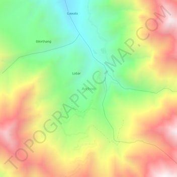
Name: Archoo topographic map, elevation, terrain.

Location: Archoo, Sankoo tehsil, Ladakh, India (34.41797 76.10675 34.45797 76.14675)

Average elevation: 3,884 m

Minimum elevation: 3,275 m

Maximum elevation: 4,592 m

Gear up for your next adventure:

🛁Quick-Dry Microfiber Towel - Space-saving towel that dries rapidly on the move
🔭Compact Monocular - One-handed bird watching and trail spotting
🔦LED Flashlight - Powerful and long-lasting flashlight for camping and emergencies
🥾Trekking Poles - Adjustable trekking poles to reduce knee stress and improve stability
💡LED Headlamp - Hands-free illumination for night hiking and camping

As an Amazon Associate, this site earns from qualifying purchases at no extra cost to you.