Calarcá topographic map
Click on the map to display elevation.
Calarcá
The municipality has an area of 219.23 km2. Urban area is 2.44 km2. Rural area is 216.79 km2. It varies in altitude between 1000 m above sea level at the confluence of the Quindío y Barragán rivers to 3667 m above sea level in the El Campanario highland area.
About this map
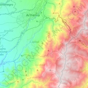
Name: Calarcá topographic map, elevation, terrain.
Location: Calarcá, Capital, Quindío, RAP Eje Cafetero, 632001, Colombia (4.33721 -75.80559 4.57137 -75.55585)
Average elevation: 2,149 m
Minimum elevation: 1,078 m
Maximum elevation: 3,726 m
Other topographic maps
Click on a map to view its topography, its elevation and its terrain.