Geolocate

Quimbaya topographic map

Click on the map to display elevation.

About this map

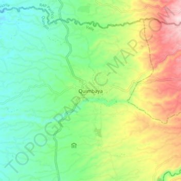
Name: Quimbaya topographic map, elevation, terrain.

Location: Quimbaya, Valle, Quindío, RAP Eje Cafetero, Colombia (4.58312 -75.80373 4.66312 -75.72373)

Average elevation: 1,306 m

Minimum elevation: 1,171 m

Maximum elevation: 1,550 m

Gear up for your next adventure:

🛏️Camping Sleeping Mat - Comfortable mats for sleeping outdoors
Camping Tent - Weather-resistant tents suitable for 2 to 6 people
Camping Groundsheet - Protect your tent from moisture and dirt
💧Hydration Pack - Hands-free hydration system for long hikes
Camping Essentials - All-in-one gear for a comfortable camping trip

As an Amazon Associate, this site earns from qualifying purchases at no extra cost to you.