Geolocate

Pamashto topographic map

Click on the map to display elevation.

About this map

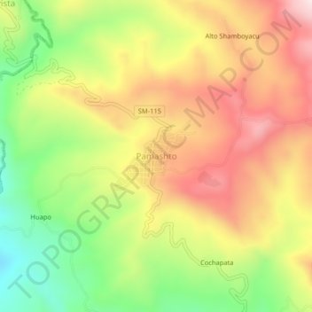
Name: Pamashto topographic map, elevation, terrain.

Location: Pamashto, Lamas, San Martín, Perú (-6.38032 -76.56303 -6.34032 -76.52303)

Average elevation: 692 m

Minimum elevation: 418 m

Maximum elevation: 954 m

Other topographic maps

Click on a map to view its topography, its elevation and its terrain.

Gear up for your next adventure:

👟Sport Hiking Sandals - Breathable footwear for water crossings and camp rest
🧴Waterproofing Spray - Restore the DWR coating on jackets and tents
🥾Light Trekking Boots - Supportive boots for multi-day treks
🧴First Aid Kit - Essential first aid supplies for outdoor emergencies
Tent Footprint - Protect tent floor and increase durability

As an Amazon Associate, this site earns from qualifying purchases at no extra cost to you.