Geolocate

Montgiraud topographic map

Click on the map to display elevation.

About this map
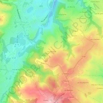
Name: Montgiraud topographic map, elevation, terrain.

Location: Montgiraud, Saint-Éloy-les-Mines, Riom, Puy-de-Dôme, Auvergne-Rhône-Alpes, France métropolitaine, 63700, France (46.13014 2.83082 46.17014 2.87082)

Average elevation: 557 m

Minimum elevation: 465 m

Maximum elevation: 673 m

Other topographic maps

Click on a map to view its topography, its elevation and its terrain.
Gear up for your next adventure:

💧Reusable Water Bottle - Durable water bottles for hydration on trails
⛺Family Camping Tent - Spacious tent suitable for family camping trips
🛶Kayak Dry Bag - Waterproof storage for kayaking adventures
🧣Evaporative Cooling Towel - Beat the heat during intense summer climbs
🥾Trail Hiking Shoes - Durable shoes designed for rugged trails

As an Amazon Associate, this site earns from qualifying purchases at no extra cost to you.