
Vembi topographic map
Click on the map to display elevation.
About this map
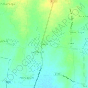
Name: Vembi topographic map, elevation, terrain.
Location: Vembi, Arcot, Ranipet District, Tamil Nadu, 632506, India (12.71337 79.38927 12.75337 79.42927)
Average elevation: 119 m
Minimum elevation: 109 m
Maximum elevation: 134 m
Other topographic maps
Click on a map to view its topography, its elevation and its terrain.
Arcot
India > Tamil Nadu > Arcot
Arcot is located at 12°54′N 79°20′E / 12.9°N 79.33°E / 12.9; 79.33. It has an average elevation of 164 metres (538 ft).
Average elevation: 169 m