
Thank you for supporting this site ❤️
Make a donation
Make a donation
Gear up for your next adventure:
As an Amazon Associate, this site earns from qualifying purchases at no extra cost to you.
Wadi Araba Sub-District topographic map
Click on the map to display elevation.
Thank you for supporting this site ❤️
Make a donation
Make a donation
Gear up for your next adventure:
As an Amazon Associate, this site earns from qualifying purchases at no extra cost to you.
About this map
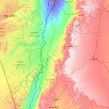
Name: Wadi Araba Sub-District topographic map, elevation, terrain.
Location: Wadi Araba Sub-District, Aqaba Qasabah District, Aqaba, Jordan (29.70953 35.04394 30.76227 35.49849)
Average elevation: 727 m
Minimum elevation: -171 m
Maximum elevation: 1,728 m
Thank you for supporting this site ❤️
Make a donation
Make a donation
Gear up for your next adventure:
As an Amazon Associate, this site earns from qualifying purchases at no extra cost to you.