Geolocate

Lathi topographic map

Click on the map to display elevation.

About this map

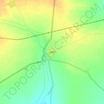
Name: Lathi topographic map, elevation, terrain.

Location: Lathi, Lathi Taluka, Amreli District, Gujarat, 364430, India (21.68472 71.35000 21.76472 71.43000)

Average elevation: 126 m

Minimum elevation: 112 m

Maximum elevation: 140 m

Gear up for your next adventure:

🧼Travel Hand Sanitizer - Keep hands clean when water is scarce
🏕️Camping Hammock - Integrated protection for sleeping between trees
🎒Fully Waterproof Backpack - Total protection for photography gear and electronics
👟Trail Running Shoes - Agile footwear for fast-paced topographic exploration
🧶550 Survival Paracord - Versatile utility cord for emergency repairs and rigging

As an Amazon Associate, this site earns from qualifying purchases at no extra cost to you.