Geolocate

Taihe County topographic map

Click on the map to display elevation.

About this map

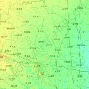
Name: Taihe County topographic map, elevation, terrain.

Location: Taihe County, Fuyang, Anhui, 236600, China (33.07643 115.38507 33.58616 115.92257)

Average elevation: 35 m

Minimum elevation: 29 m

Maximum elevation: 43 m

Gear up for your next adventure:

🥾Hiking Shoes - Durable and comfortable shoes for trail hiking
🪑Ultralight Camping Stool - Compact seating for rest stops during long hikes
Camping Tent - Weather-resistant tents suitable for 2 to 6 people
🏃Hydration Running Vest - Carry water and maps close to your body for speed
🩹Moleskin Blister Pads - Direct protection for painful foot pressure points

As an Amazon Associate, this site earns from qualifying purchases at no extra cost to you.