Geolocate

Hays topographic map

Click on the map to display elevation.

About this map

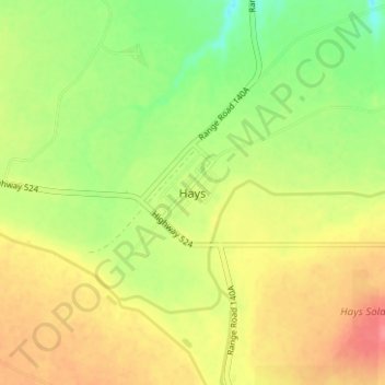
Name: Hays topographic map, elevation, terrain.

Location: Hays, Division No. 2, Alberta, Canada (50.07718 -111.81501 50.11718 -111.77501)

Average elevation: 781 m

Minimum elevation: 747 m

Maximum elevation: 812 m

Gear up for your next adventure:

🧊Insulated Water Bottle - Keeps drinks cold in summer and prevents freezing in winter
🧥Packable Rain Jacket - Breathable waterproof layer for unpredictable weather
🍽️Titanium Camping Spork - Ultralight and indestructible eating utensil
🚑Survival Whistle - Signal for help across long distances in mountains
🧣Merino Neck Gaiter - Protects against wind, sun, and cold at high altitudes

As an Amazon Associate, this site earns from qualifying purchases at no extra cost to you.