Geolocate

Valia topographic map

Click on the map to display elevation.

About this map

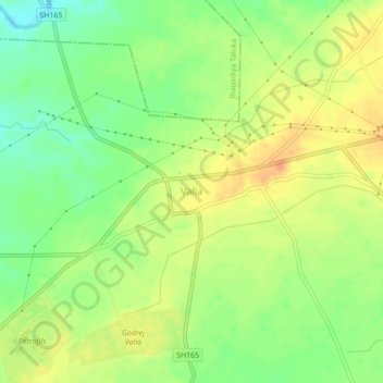
Name: Valia topographic map, elevation, terrain.

Location: Valia, Valia Taluka, Bharuch, Gujarat, 393135, India (21.55111 73.14088 21.59111 73.18088)

Average elevation: 52 m

Minimum elevation: 30 m

Maximum elevation: 71 m

Gear up for your next adventure:

Family Camping Tent - Spacious tent suitable for family camping trips
🔋Emergency Crank Radio - Weather alerts and power without needing batteries
🧴Insect Repellent - Protect yourself from bugs during outdoor adventures
🥾Hiking Gaiters - Protect legs and shoes from mud, snow, and debris
🛶Kayak Accessories - Essential gear for safe and fun kayaking adventures

As an Amazon Associate, this site earns from qualifying purchases at no extra cost to you.