Geolocate

Königsbrunn topographic map

Click on the map to display elevation.

About this map

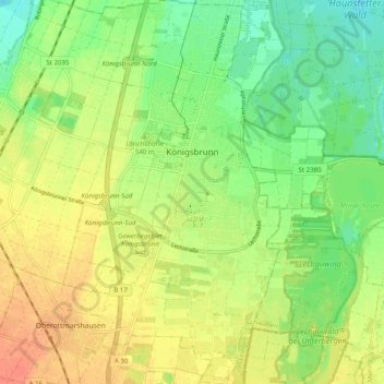
Name: Königsbrunn topographic map, elevation, terrain.

Location: Königsbrunn, Augsburg (district), Bavaria, 86343, Germany (48.22809 10.85511 48.29387 10.91135)

Average elevation: 520 m

Minimum elevation: 499 m

Maximum elevation: 542 m

Other topographic maps

Click on a map to view its topography, its elevation and its terrain.

Erlingen

Germany > Bavaria > Augsburg (district) > Meitingen

Average elevation: 435 m

Gear up for your next adventure:

🧴Sunscreen SPF - Broad-spectrum sunscreen for outdoor activities
🥾Hiking Shoes - Durable and comfortable shoes for trail hiking
🛌Insulated Sleeping Pad - Critical thermal barrier between you and the cold ground
🛏️Sleeping Bag - Warm and compact sleeping bags for outdoor camping
📷Outdoor Action Camera - Capture high-elevation views and rugged adventures

As an Amazon Associate, this site earns from qualifying purchases at no extra cost to you.