Geolocate

Gadingan topographic map

Click on the map to display elevation.

About this map

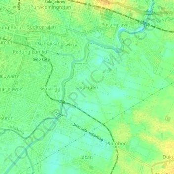
Name: Gadingan topographic map, elevation, terrain.

Location: Gadingan, Sukoharjo, Central Java, Java, 57125, Indonesia (-7.60309 110.82696 -7.56309 110.86696)

Average elevation: 92 m

Minimum elevation: 80 m

Maximum elevation: 106 m

Other topographic maps

Click on a map to view its topography, its elevation and its terrain.

Puron

Indonesia > Central Java > Sukoharjo

Average elevation: 128 m

Bulu

Indonesia > Central Java > Sukoharjo

Average elevation: 126 m

Lapangan Makamhaji

Indonesia > Central Java > Sukoharjo > Gentan > Kuyudan

Average elevation: 104 m

Waduk Mulur

Indonesia > Central Java > Sukoharjo > Bendosari

Average elevation: 114 m

Karangasem

Indonesia > Central Java > Sukoharjo > Karangasem

Average elevation: 115 m

Gear up for your next adventure:

💧Hydration Pack - Hands-free hydration system for long hikes
🍽️Titanium Camping Spork - Ultralight and indestructible eating utensil
🎒Backpack Rain Cover - External shield to keep your entire pack dry
🧢Outdoor Cap - Protective cap for sun and rain during hikes
🛶Kayak Dry Bag - Waterproof storage for kayaking adventures

As an Amazon Associate, this site earns from qualifying purchases at no extra cost to you.