Geolocate

Flen topographic map

Click on the map to display elevation.

About this map

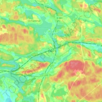
Name: Flen topographic map, elevation, terrain.

Location: Flen, Flens kommun, Södermanland County, 642 36, Sweden (59.01678 16.54930 59.09678 16.62930)

Average elevation: 44 m

Minimum elevation: 18 m

Maximum elevation: 82 m

Gear up for your next adventure:

🛶Waterproof Dry Bags - Keep electronics and clothes dry during river crossings
🩹Moleskin Blister Pads - Direct protection for painful foot pressure points
Lightweight Backpacking Tent - Compact tent for efficient hiking trips
🧊Insulated Water Bottle - Keeps drinks cold in summer and prevents freezing in winter
🔥Emergency Fire Starter - Reliable ignition source for all weather conditions

As an Amazon Associate, this site earns from qualifying purchases at no extra cost to you.