Geolocate

Manitôt topographic map

Click on the map to display elevation.

About this map
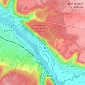
Name: Manitôt topographic map, elevation, terrain.

Location: Manitôt, Vernon, Les Andelys, Eure, Normandie, France métropolitaine, 27200, France (49.06767 1.48985 49.10767 1.52985)

Average elevation: 77 m

Minimum elevation: 8 m

Maximum elevation: 144 m

Other topographic maps

Click on a map to view its topography, its elevation and its terrain.

Château des Tourelles

France > Normandie > Eure > Vernon

Average elevation: 52 m

27200

France > Normandie > Eure > Vernon

Average elevation: 89 m

Gear up for your next adventure:

⛺Camping Essentials - All-in-one gear for a comfortable camping trip
🔋Lithium AA Batteries - Long-lasting power that performs in extreme cold
🧢Outdoor Cap - Protective cap for sun and rain during hikes
🧴Waterproofing Spray - Restore the DWR coating on jackets and tents
🔪Outdoor Multitool - Versatile tool for repairs and food prep in the wild

As an Amazon Associate, this site earns from qualifying purchases at no extra cost to you.