
Tindivanam topographic map
Click on the map to display elevation.
Tindivanam
Tindivanam is located at 12°15′N 79°39′E / 12.25°N 79.65°E / 12.25; 79.65. It has an average elevation of 58 metres (190 feet). Tindivanam is 120 km (75 mi) southwest from Chennai and 35 km (22 mi) northwest from Pondicherry. Tindivanam is one among the three sub-divisions of Viluppuram District, Tamil Nadu. This small town lies about 65 km (40 mi) northwest of Cuddalore. Tindivanam is divided into 234 Revenue Villages under Tindivanam Taluk.
About this map
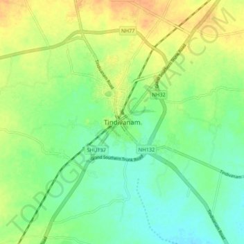
Name: Tindivanam topographic map, elevation, terrain.
Location: Tindivanam, Viluppuram, Tamil Nadu, 604001, India (12.18617 79.61150 12.26617 79.69150)
Average elevation: 44 m
Minimum elevation: 29 m
Maximum elevation: 62 m