
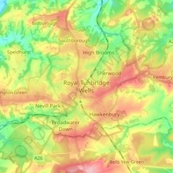
Royal Tunbridge Wells topographic map
Interactive map
Click on the map to display elevation.
About this map
Name: Royal Tunbridge Wells topographic map, elevation, terrain.
Average elevation: 99 m
Minimum elevation: 27 m
Maximum elevation: 181 m
Other topographic maps
Click on a map to view its topography, its elevation and its terrain.
Five Oak Green
United Kingdom > England > Kent > Tunbridge Wells
Five Oak Green, Tunbridge Wells, Kent, England, TN12 6SZ, United Kingdom
Average elevation: 28 m