
Bailey topographic map
Click on the map to display elevation.
About this map
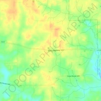
Name: Bailey topographic map, elevation, terrain.
Location: Bailey, Tangipahoa Parish, Louisiana, United States (30.85907 -90.35842 30.89907 -90.31842)
Average elevation: 83 m
Minimum elevation: 64 m
Maximum elevation: 97 m
Other topographic maps
Click on a map to view its topography, its elevation and its terrain.
Ponchatoula
United States > Louisiana > Tangipahoa Parish
Ponchatoula is located at 30°26′21″N 90°26′33″W / 30.43917°N 90.44250°W / 30.43917; -90.44250 (30.439162, -90.442507) and has an elevation of 26 feet (7.9 m). According to the United States Census Bureau, the city has a total area of 4.2 square miles (11 km2), all land.
Average elevation: 9 m
Hammond
United States > Louisiana > Tangipahoa Parish
Hammond is located at 30°30′16″N 90°27′56″W / 30.50444°N 90.46556°W / 30.50444; -90.46556 (30.504446, -90.465616) and has an elevation of 43 feet (13.1 m). According to the United States Census Bureau, the city has a total area of 12.8 square miles (33 km2), of which 12.8 square miles (33…
Average elevation: 13 m
Ponchatoula
United States > Louisiana > Tangipahoa Parish
Ponchatoula is located at an elevation of 26 feet (7.9 m). According to the United States Census Bureau, the city has a total area of 4.2 square miles (11 km2), all land.
Average elevation: 9 m