Geolocate

Lithopolis topographic map

Click on the map to display elevation.

About this map

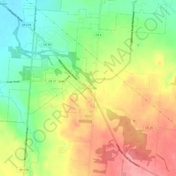
Name: Lithopolis topographic map, elevation, terrain.

Location: Lithopolis, Fairfield County, Ohio, 43136, United States (39.78284 -82.82628 39.82284 -82.78628)

Average elevation: 277 m

Minimum elevation: 228 m

Maximum elevation: 327 m

Gear up for your next adventure:

👟Sport Hiking Sandals - Breathable footwear for water crossings and camp rest
Camping Coffee Maker - Brew fresh coffee anywhere on the topographic map
🧣Evaporative Cooling Towel - Beat the heat during intense summer climbs
🧦Thermal Socks - Warm socks for winter hiking or camping
🧢Sun Hat - Wide-brim hat for sun protection

As an Amazon Associate, this site earns from qualifying purchases at no extra cost to you.