Geolocate

Mauna topographic map

Click on the map to display elevation.

About this map

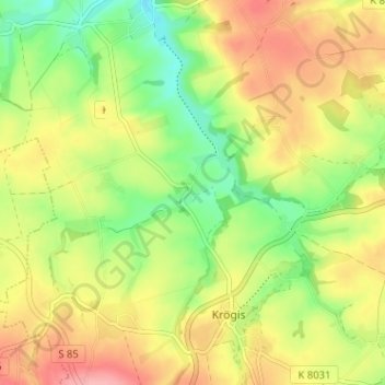
Name: Mauna topographic map, elevation, terrain.

Location: Mauna, Krögis, Käbschütztal, Meißen, Saxony, Germany (51.11313 13.35379 51.15313 13.39379)

Average elevation: 205 m

Minimum elevation: 154 m

Maximum elevation: 257 m

Gear up for your next adventure:

🧢Hiking Hat - Sun-protective and breathable hats for long treks
🧶550 Survival Paracord - Versatile utility cord for emergency repairs and rigging
🧦Crew Hiking Socks - Comfortable socks for long-distance hikes
🔋Emergency Crank Radio - Weather alerts and power without needing batteries
🕶️Polarized Sunglasses - Protect your eyes with durable polarized lenses

As an Amazon Associate, this site earns from qualifying purchases at no extra cost to you.