Geolocate

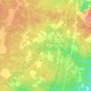
Maa topographic map

Click on the map to display elevation.

About this map

Name: Maa topographic map, elevation, terrain.

Location: Maa, Rion-des-Landes, Arrondissement de Dax, Landes, Nouvelle-Aquitaine, France métropolitaine, 40370, France (43.91876 -0.94408 43.95876 -0.90408)

Average elevation: 73 m

Minimum elevation: 53 m

Maximum elevation: 88 m

Other topographic maps

Click on a map to view its topography, its elevation and its terrain.
Gear up for your next adventure:

🛰️Satellite Messenger - Emergency communication for areas with no cell service
🛌Down Sleeping Bag - Superior warmth-to-weight ratio for cold nights
🧳Compression Sacks - Maximize space in your backpack by shrinking gear
🔦LED Flashlight - Powerful and long-lasting flashlight for camping and emergencies
🧦Outdoor Socks - Durable socks designed for hiking and outdoor sports

As an Amazon Associate, this site earns from qualifying purchases at no extra cost to you.