
Thank you for supporting this site ❤️
Make a donation
Make a donation
Gear up for your next adventure:
As an Amazon Associate, this site earns from qualifying purchases at no extra cost to you.
Bhaniyawala topographic map
Click on the map to display elevation.
Thank you for supporting this site ❤️
Make a donation
Make a donation
Gear up for your next adventure:
As an Amazon Associate, this site earns from qualifying purchases at no extra cost to you.
About this map
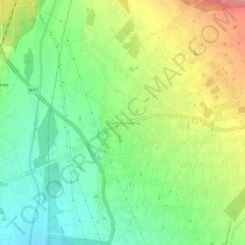
Name: Bhaniyawala topographic map, elevation, terrain.
Location: Bhaniyawala, Rishikesh, Dehradun, Uttarakhand, 248016, India (30.16638 78.12850 30.20638 78.16850)
Average elevation: 510 m
Minimum elevation: 470 m
Maximum elevation: 568 m
Thank you for supporting this site ❤️
Make a donation
Make a donation
Gear up for your next adventure:
As an Amazon Associate, this site earns from qualifying purchases at no extra cost to you.