Geolocate

Springfield topographic map

Click on the map to display elevation.

About this map
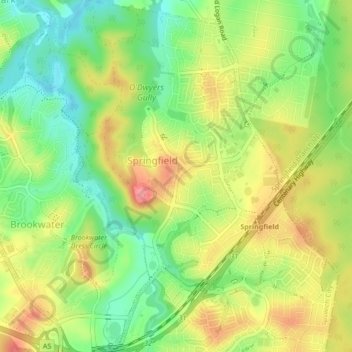
Name: Springfield topographic map, elevation, terrain.

Location: Springfield, Ipswich, Brisbane, Queensland, Australia (-27.67459 152.89350 -27.63686 152.92472)

Average elevation: 62 m

Minimum elevation: 20 m

Maximum elevation: 109 m

Other topographic maps

Click on a map to view its topography, its elevation and its terrain.

Gear up for your next adventure:

🧢Outdoor Visor - Breathable visor for sunny hikes
🥾Approach Boots - Comfortable boots for hiking and climbing approaches
🧳Compression Sacks - Maximize space in your backpack by shrinking gear
🧦Merino Wool Socks - Moisture-wicking comfort for long-distance hiking
🚑Survival Whistle - Signal for help across long distances in mountains

As an Amazon Associate, this site earns from qualifying purchases at no extra cost to you.