
Thank you for supporting this site ❤️
Make a donation
Make a donation
Gear up for your next adventure:
As an Amazon Associate, this site earns from qualifying purchases at no extra cost to you.
Chicches topographic map
Click on the map to display elevation.
Thank you for supporting this site ❤️
Make a donation
Make a donation
Gear up for your next adventure:
As an Amazon Associate, this site earns from qualifying purchases at no extra cost to you.
About this map
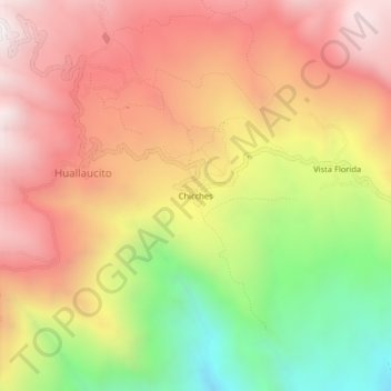
Name: Chicches topographic map, elevation, terrain.
Location: Chicches, Huallaucito, Chillia, Pataz, La Libertad, Perú (-8.23665 -77.49854 -8.19665 -77.45854)
Average elevation: 2,886 m
Minimum elevation: 2,089 m
Maximum elevation: 3,496 m
Thank you for supporting this site ❤️
Make a donation
Make a donation
Gear up for your next adventure:
As an Amazon Associate, this site earns from qualifying purchases at no extra cost to you.