
Kocaeli topographic map
Interactive map
Click on the map to display elevation.
About this map
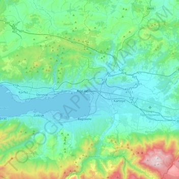
Name: Kocaeli topographic map, elevation, terrain.
Location: Kocaeli, İzmit, Kocaeli, Marmararegion, 41100, Türkei (40.60323 29.76626 40.92323 30.08626)
Average elevation: 293 m
Minimum elevation: -2 m
Maximum elevation: 1,588 m
Other topographic maps
Click on a map to view its topography, its elevation and its terrain.