Geolocate

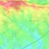
Haute Fontaine topographic map

Click on the map to display elevation.

About this map

Name: Haute Fontaine topographic map, elevation, terrain.

Location: Haute Fontaine, Ruillé-le-Gravelais, Loiron-Ruillé, Laval, Mayenne, Pays de la Loire, France métropolitaine, 53320, France (48.03701 -0.98316 48.07701 -0.94316)

Average elevation: 135 m

Minimum elevation: 96 m

Maximum elevation: 195 m

Other topographic maps

Click on a map to view its topography, its elevation and its terrain.
Gear up for your next adventure:

💧Reusable Water Bottle - Durable water bottles for hydration on trails
🧭GPS Outdoor Watch - Smart watch for navigation and fitness tracking in nature
🧶550 Survival Paracord - Versatile utility cord for emergency repairs and rigging
⛺Bushcraft Tarp - Versatile emergency shelter or gear protection
💧Filtered Water Bottle - Safe drinking water on the go

As an Amazon Associate, this site earns from qualifying purchases at no extra cost to you.