Geolocate

Boussens topographic map

Click on the map to display elevation.

About this map

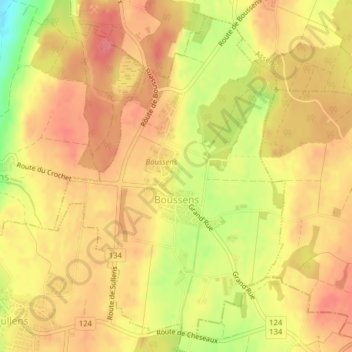
Name: Boussens topographic map, elevation, terrain.

Location: Boussens, District du Gros-de-Vaud, Vaud, 1034, Switzerland (46.59196 6.57086 46.61649 6.59670)

Average elevation: 599 m

Minimum elevation: 550 m

Maximum elevation: 622 m

Gear up for your next adventure:

🥤Collapsible Travel Cup - Saves space and weight in your mess kit
🧥Waterproof Hiking Jacket - Protect yourself from rain and wind while hiking
🕶️Polarized Sunglasses - Protect your eyes with durable polarized lenses
🧣Merino Neck Gaiter - Protects against wind, sun, and cold at high altitudes
🥾Waterproof Hiking Shoes - Durable shoes for wet and rugged trails

As an Amazon Associate, this site earns from qualifying purchases at no extra cost to you.