Geolocate

Dentam topographic map

Click on the map to display elevation.

About this map

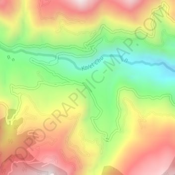
Name: Dentam topographic map, elevation, terrain.

Location: Dentam, Gyalshing, Sikkim, India (27.25118 88.12931 27.27118 88.14931)

Average elevation: 1,522 m

Minimum elevation: 1,143 m

Maximum elevation: 1,904 m

Gear up for your next adventure:

🧦Thermal Socks - Warm socks for winter hiking or camping
💧Hydration Pack - Hands-free hydration system for long hikes
🥾Light Hiking Boots - Lightweight and comfortable boots for day hikes
🧢Sun Hat - Wide-brim hat for sun protection
💧Collapsible Water Bottle - Space-saving water bottle for outdoor activities

As an Amazon Associate, this site earns from qualifying purchases at no extra cost to you.